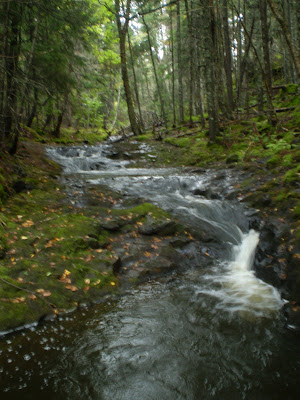
MILL BRIDGE BROOK FALLS
Baxters Harbour, Kings County
N 45° 13.359 W 064° 31.557
20T E 380198 N 5008799
RIVER: Mill Bridge Brook
CLASS: cascade
SIZE: 1 5'
RATING: average (**1 /2)
TRAIL: wood trail
DISTANCE: 550m
HIKING TIME: 45 minutes
CONDITIONS: moderate
GEOCACHE: none
NS Atlas Page: 46/Z1
NS topo map: 021H02 (Berwick)
DIRECTIONS: from Kentville, take Exit 11 , northbound, on HWY358, approximately 10km, to where it meets HWY 221 . Turn left, following this highway, 4.5km to Sheffield Mills, turning right onto Black Hole Rd. Travel up thru Sleepy Hollow, to the top of North Mountain, turning left at Glenmont onto Baxters Harbour Rd. When you reach the harbour, turn left, onto Old Baxter Mill Rd, approximately 1.2 km, parking on the far side of the bridge over Mill Bridge Brook.
Trail Description: cross the road and make your way down to the stream alongside the bridge. There is a path that can mostly be followed upstream, but it is criss-crossed by deadfall, and is hard to see in places. There are numerous smaller falls, some up to 8 feet high, along the path up to the main falls, which are a
peaceful twin cascade.


No comments:
Post a Comment