Tuesday 31 July 2012


COBBY IRVING FALLS
Baxters Harbour, Kings County
N 45° 13.985 W 064° 29.962

20T E 382319 N 5009951


RIVER: Cobby I rving Brook
CLASS: cascade (steep)
SIZE: 45'
RATING: excellent (****)

TRAIL: downstream
DISTANCE: >200m
HIKING TIME: 20 minutes
CONDITIONS: challenging

Geocache: GC1 A9HM

NS Atlas Page: 57/V1
NS topo map: 021H01 (Wolfville)


DIRECTIONS: from Kentville, take Exit 1 2 off HWY #1 01 , travelling northward. Follow this road (Middle Dyke Rd. ) to its conclusion at Chipmqn Corner,approximately 5.5 km, turn left and then right again after about 1 00m. Follow this continuation of Middle Dyke Rd to its intersection with HWY #221 another 4km along. Turn right onto this highway, and drive 1 .5km to Sheffield Mills. Turn left here onto Baxters Harbour Rd. Drive up over North Mountain , following this road even after it turns into a dirt road. When you near the falls site, there is a hard left-had turn, proceed around this and park near the brook. There is no bridge here, so you have to maintain a vigilant eye for the streams corssing underneath the road.

Trail Description: walk in along the right hand side of the book, there is no hard trail to the sote. These is a driveway that parallels the canyon rim along this route, but it is on priate property, so your best bet is to keep to the canyon edge until you come to the falls site. There is a rope to assist with descent into the gorge just beyond on the right hand side. Be very cautious as this is a step and long drop to the streambed below.


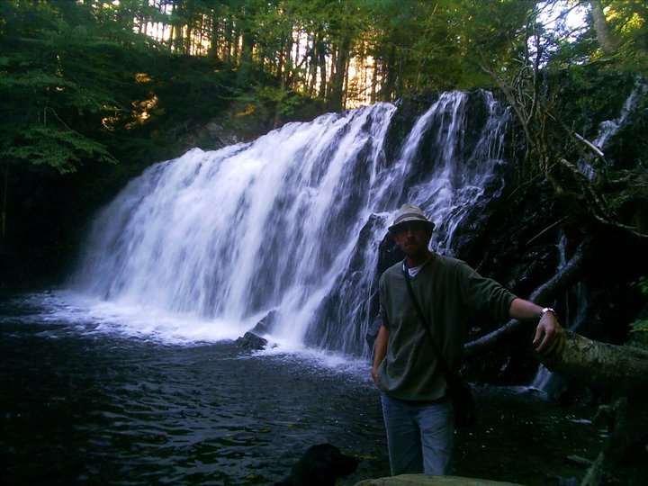
Absoluely beautiful falls, the Cobby I rving Brook descends thru a small notch in the bedrock at the top of the fall, plunging 30 feet in a gentle spray (unless the stream is swollen after a hurricane in which it is a torrent), landing on an outcropping of stone and cascading down the rest of the way to the streambed. In high summer, at minimum water flowage, it is possible to get in behind the plunge and look out at the world thru the waterfall. The canyone itself is spectacular, with hundred year old birch trees gripping onto house sized boulders. There is not much of a plunge pool.

cobby irving falls in the winter
photo by scotianhiker


HARDING BROOK FALLS
Melanson, Kings County
N 45° 04.144 W 064° 18.935
20T E 0396436 N 4991 463


RIVER: Harding Brook
CLASS: staircase (steep)
SIZE: 55'
RATING: average (**1 /2)

TRAIL: none
DISTANCE: 1 50m
HIKING TIME: 20min
CONDITIONS: challenging

NS Atlas Page: 47/W3
NS topo map: 021 H01 (Wolfville)


DIRECTIONS: from Kentville, follow HWY #101 eastwards, towards Wolfville. Take Exit10, south, and turn right onto Ridge Road. Continue 4km to its conclusion, turning left onto Martin Cross Road.Folow this to its conclusion, about 1 .5km. Turn left onto Melanson Road, folooing the hill down and across the bridge. When you get to the other side of the bridge, continue straight on Melanson Road, up the mountain. Parking is not easily evident here, there is a pullin halfway along the big field on your right hand side as you ascend the mountain, and there is a rural delivery mailbox approximately 500m further along uphill. There is very little room to pull off along side the road.

Trail Description: from the postal box, make your way into the woods and down the steep hill to Harding Brook. Follow this brook downstream, there are several deep spots in the stream, and multiple stream crossings will be necessary. The falls are approximately 500m downstream, on the right hands side,
feeding directly into the stream.

Also called "Ethereal Castle Falls" the beauty of this location is much reduced by the garbage and derelict vehicle which covers the middle tier of these wonderful falls. In high water, these falls are quite spectacular, and the only reason the rating given is low is due to the litter.


Just downstream of these falls, along the main stream, is a beautiful series of zig-zag canyons, with high shale cliffs and fossils. Nearby this site, where Harding Brook meets the Gaspereau River, was the site of an early Acadian village called Melanson; there is also much evidence of a lithic factory site of the Mi'kmaq during the Early Maritime Woodland Period (ca. 2400bp--ca.1050bp), as well as hearths that may have been used in sweat lodges and cooking.


GLEN BROOK FALLS
Rawdon Gold Mines, Hants County
45N02.343  3.W52.717
20T E0430799 N4987664


RIVER: Glen Brook
CLASS: plunge
SIZE: 15'
RATING: excellent

TRAIL: wood road
DISTANCE: 500 km
HIKING TIME: 30 minutes
CONDITIONS: moderate

GEOCACHE: none

NS Atlas Page: 48/X4
NS topo page: 011E04 (Kennetcook)

DRIVING DIRECTIONS: from Windsor, take Exit5 off HWY101, eastbound, towards Brooklyn on HWY14. Turn left at the war memorial in that village, 8.6km along, heading up the hill and trending right as HWY14 continues about 1km further along. Drive down HWY14 a further 16.8km, turning left onto HWY202. Follow this road 550m to Meehan and Richardson Road can be rough at times. Watch for a dirt road to your right at 1.2km. Park off the side of the road here.

TRAIL CONDITIONS: walk down the hill along the road to the end. Follow the evident path to your right alongside the top of the ridge to the falls.


At one time, well taken care of, the stairs leading down to the base of the falls are no longer safe, but the platform above is still sturdy enough to offer a nice view of the falls. Hiking downstream a few meters, there are steep descents to the base of the ravine, hike back upstream along the left hand side to the falls.


LeBREAU BROOK FALLS
Martock, Hants County
45N56.999  64W08.287
20T E0410221 N4978024


RIVER: Lebreau Brook
CLASS: plunge (steep)
SIZE 15'
RATING: average (***)

TRAIL: woods trail
DISTANCE: 200m
HIKING TIME: 30 minutes
CONDITIONS: moderate

NS Atlas Page: 57/Y2
NS topo map: 021A16 (Windsor)


DRVING DIRECTIONS: take Exit5 off HWY101, westbound, towards Windsor and Three Mile Plains. Follow this road, HWY14, to its conclusion about 1km along. (Across from the gas station) Turn left onto HWY1 and drive 650m to Three Mile Plains Cross Road. Turn right onto this and drive 850m to its intersection with Windsor Back Road. Turn right again, and drive down Windsor Back Road 2.8km to a dirt road on your left. Pull down this and drive down to the big old trees by the pond. Park here.

TRAIL DESCRIPTION: Follow the road around the small quarry to a fork in the trail about 75m along. Turn left along this trail that runs along the powerlines, and follow it to Lebreau Brook, about 100 along. Hike upstream alongside the brook to the fenceline. Cross under this old fence and hike up alongside the brook on the right hand side on a trail. You will hear the falls in the ravine as it gets deeper, just angle back to your left to the falls.

Further upstream, the brook features many smaller cascades that drop considerable distances over a short run of the stream, making it quite a picturesque hike.


A small 4 or 5 foot fall is also located just downstream from where the lower trail crosses over Lebreau Brook.


ST. CROIX DAM FALLS
St. Croix, Hants County

N 44° 57.713 W 064°01.967
20T E 41 8547 N 497235


RIVER: St. Croix River
CLASS: cascade/dam
SIZE: 15'
RATING: average (***)

TRAIL: roadside
DISTANCE: <100m
HIKING TIME: 5 min
CONDITIONS: easy

NS Atlas Page: 57/Z1
NS topo map: 021A16 (Windsor)


DIRECTIONS: from Windsor, take Exit 4 from HWY101, westward towards Windsor/Newport Station. Follow this road 1.5km to the bridge across the St. Croix River. Park just beyond the bridge, near the Acadian Heritage sign.


Trail Description: walk back onto the sidewalk on the bridge for the best view of the falls.

These falls are just below the lower dam of the St. Croix Rvier hydroelectric system. The main dam, an imposing sixty foot concrete structure is upstream and can be reached and viewed by travelling to the end of Salmon Hole Road, which is just a little west of this location. There are camping areas at the base of the dam and good fishing for small-mouth bass there. The hydroelectric plant here, at the bridge, dates back to 1934.


Also noteworthy is that this is the site of the Battle of St. Croix in 1750. The precedent to this battle lay in the Seige of Grand-Pre when Mi'kmaq and Acadian militia attacked and blockaded Fort Vieux Logis, at present day Hortonville, Kings County for a week during November 1749, as well as an incident which occured on September 30, 1749, when approximately forty Mi'kmaq attacked six men who were cutting trees at a saw mill near Dartmouth, Nova Scotia. Four of these men were killed, another was taken prisoner and the sixth lumberjack escaped. Two of the deceased men were scalped and the heads of the other two were cut off. In response to this raid, Governor Edward Cornwallis offered a bounty on the head of every Mi'kmaq, setting the reward at the same rate that the Mi'kmaq received from the French for British scalps.

photo by Melanie Haverstock (2015)

The Battle at St. Croix came about as New England Rangers under the command of Captain John Gorham were en route to Grand Pre and Pisiquid (present day Windsor) to arrest the Acadians who had supported the siege, and seize their property. Arriving at about noon on March 20, 1 750 at the site of the Acadian village of Five Houses, which had been established alongside the St. Croix River, Gorham found the settlement deserted.

photo by Melanie Haverstock (2014)

Upon spotting a group of Mi’kmaq hiding in the bushes on the opposite shore of the river, the Rangers opened fire on them. The skirmish quickly deteriorated into a siege, and Gorham and his Rangers were forced to take refuge in a sawmill and two of the houses in the village. During the fighting, which spread to the area still known as "Battle Hill", the Rangers suffered three wounded, which included Gorham himself, who sustained a bullet in his thigh. As the fighting intensified, Gorham sent a runner back to Fort Sackville (present day Bedford) for reinforcements. Responding to the call for assistance on March 22, Governor Cornwallis sent Captain Clapham’s and Captain St. Loe’s Regiments, along with two field guns, to assist Gorham at Pisiquid. The additional troops and artillery turned the tide for Gorham, and forced the Mi’kmaq
to withdraw.


ROARING BROOK FALLS
Upper Vaughan, Hants County
44N46.452  64W14.650
20T E0401553 N4958611


RIVER: Roaring Brook
CLASS: mixed
SIZE: 18', 25'
RATING: average (***)

TRAIL: none
DISTANCE: 1.5km
HIKING TIME: 1 hour
CONDITIONS: moderate

GEOCACHE: none

NS Atlas Page: 57/X5
NS topo map: 021A16 (Windsor)


DRIVING DIRECTIONS: from Windsor, take Exit5, onto HWY14, west towards Windsor. At its intersection with HWY1, approximately 1km along, turn right and continue 1.8km. Turn left onto Chester Road (HWY14) (Watch for signs for Martock Ski Hill) Continue down this road 26.3km, nearly to the county bountry with Lunenburg County. Watch for a dirt road on your left, pull in here and park. There is also an old portion of the highway about 500m back up the road that has plenty of parking. 

Trail Description: walk down the side of the highway about 400m to where Roaring Brook crosses under the highway, and make your way downstream. There is no trail to these falls, so its a mixture of strolling thru a mature forest with a tall overstory and rock hopping down this trickling brook.

The top set of falls is a steep slide fall and cascade of about 18 feet in height. The brook spits in two below the top falls, and each branch has a nice waterfall on it where the brook runs over the hill. The stream then joins back together a few hundred meters below the falls and runs, eventually, into Zwickers Lake, then along the Avon to the Minas Basin.


If you approach from the second parking area, walk down the highway about 200m, watch for the old road on your right. Walk down this long unused portion of the Chester Road to the bottom of its curve and angle into the woods. Its about a 600m bushwhack in from here to Roaring Brook, but its mostly downhill and the forest is fairly open so it is quite a pleasant hike. When you reach Roaring Brook, turn upstream and follow the edges of the brook to the falls.

Both sides of the lower falls are quite nice, with one bearing a concentrated plunge after an initiam small plunge while the oteher is more of a busy cascade.

The top falls, unless its heavy water in the spring freshet, slide over the face of the rock, barely making a ripple. 


Monday 30 July 2012

WOOD BROOK FALLS
South Rawdon,Hants County
45N01.089  63W51.587
20T E 0432258 N 498326

 )First Wood Brook Falls(


RIVER: Wood Brook
CLASS: multiple falls
SIZE: 20', 10', 10', 15', 20', 50'
RATING: excellent

photo by Jerry Johnson (2014)

TRAIL: wood road & bushwhacking
DISTANCE:  about 1 km
HIKING TIME: 2 hours
CONDITIONS: mixed
(Lower Wood Brook Falls)
NS Atlas Page: 48/W5
NS topo page: 011E04 (Kennetcook)

DRIVING DIRECTIONS: from WINDSOR: take Exit5 from HWY101, turning west on HWY14. Travel down this road 8.6km thru the village of Brooklyn, turning left at the war memorial in the middle of the road to remain on HWY14. Continue another 4.8km and turn right onto Ashdale Road, and remain to the left at the intersection at the bottom of the hill, to remain on Ashdale Road. Follow Ashdale Rd 8.7km, watching for a dirt road to your left. If you reach the intersection with HWY202, you have gone about 700m too far. Pull in and off to the side.

photo by Andrew Paul (2014)

TRAIL DESCRIPTION: Wood Brook runs parallel to this old woods road, and you can head into the woods nearly anywhere along this road and reach the brook within 100m. The woods are the gentlest to the brook within the first few hundred meters along this old road. Hike down to the brook and hike downstream. The first set of falls is approximately 400m from Ashdale Rd, and the furthest are approximately 1km from the parking area. 

photo by Andrew Paul (2014)

There are some steep descents and ascents heading downstream, but it is quite the exhilarating hike, coming across one waterfall after another. The first set of falls at 45N01.089 63W51.587 is a steep vertical plunge of 20 feet with a large pool at its base. The second set of falls are a double set of falls of 25 feet and 15 feet in two separate drops. The upper drop is located at 45N01.247 63W51.595. The second drop is located less than 30m downstream and features a beautiful view of both upper and lower cascades.


The third set of falls on this brook is at 45N01.335 63W51.616. The stream throws itself into a cataract as it carves thru the rocky streambed, and heading downstream, the canyon begins to close in on you...

(Third Wood Brook Falls)

The fourth set of falls you encounter along Wood Brook are ore steep cascades within the confines of the canyon, an opposite of some of the beautiful plunges seen upstream. Making ones way down to the Lower Wood Brook Falls hike down the brook itself, rockhopping as necessary... the walls are sheer rock and the sun disappears most of the time, the birdsong disappears, and this merry little brook carves its way thru it in dozens of three and four foot cascades packed one after another.The prettiest vantage, Ive thot, the couple times ive done this hike is at  45N01.407 63W51.693. Theres an otherworldliness about this canyon.


photo by Jerry Johnson (2014)


The fifth and lower set of falls, by far the most impressive of the falls on this brook, measuring about 50' feet in height, is at 45N01.407 63W51.693. To get a good view of these falls from the base, you will need to continue past the falls along the ridge on the left hand side of the falls, continueing on a few hundred meters until you can find a safe descent into the tight corner canyon that these falls drop into. When you approach the bottom, you are forced to sit up on the deadfall scant meters away from the falls, they are pretty awesome to comprehend.

photo by Andrew Paul (2014)

I would rate Wood Brook Falls as one of the nicest hikes in Hants County for a waterfall enthusiast. The lasd which the brook runs thru is up for sale, so maybe all of THIS blog thingy could lead to a book afterall and the possibility of buying the land that encompasses these wonderful falls.

photo by Jerry Johnson (2014)

TEAPOT FALLS
45N57.987  60W40.440
20T E 680214 N5092950

photo - Robert Peirrynowski (2008)

RIVER: South Branch Benacadie River
CLASS: steep cascade
SIZE: 25'
RATING: excellent (***1 /2)

TRAIL: bushwhacking
DISTANCE: 3km
HIKING TIME: 4.5 hours
CONDITIONS: difficult

Geocache: GC15T3K

NS Atlas Page: 23/X1
NS topo map: 011F15 (Grand Narrows)

Driving Directions: from Sydney, take Exit6W south onto HWY4 towards St.Peter's. Drive 12.7km and turn right onto HWY216 towards Eskasoni First Nation. Follow this road 27.1km and turn right onto George St in the village of Eskasoni. After 550m turn left onto Eskasoni Road and drive 4km, trending right at the intersection onto Highlands Road. Drive 1.6km to a dirt road on your right. Park at the roadside pullout on your right.

Trail Description: hike upstream past Benacadie Falls, climbing up over the right hand side of them. Follow the river further upstream another 300m to the fork in the river and take the right hand path. Conntinue upstream another 750m or so to these falls.

photo - Robert Pierrynowski (2008)

They are named Teapot Falls for the colour of the water, rich brown, that goes over the falls. This is another set of falls who get their name from the geocaching community, and I've stuck with the name. A smaller cascade at the lower section is easily traversed and the lasrger upper portion of the fall plunges down into a small pool. A serious hike with no real trails, the reward at the end is finding a spot in nature rarely seen by others.

photo - Robert Pierrynowski (2008)