Ardness, Pictou County
45N40.643 62W13.174
20T E560784 N5058499

photo Benoit Lalonde
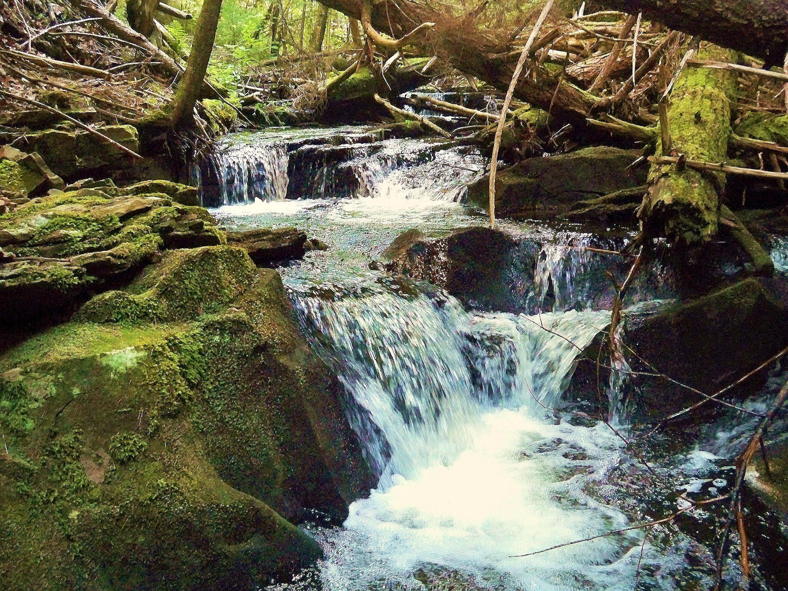
RIVER: Vameys Brook
CLASS: plunge/cascade/plunge
SIZE: 30', 20', 30'
RATING: average (***1 /2)
TRAIL: bushwhacking/upstream
DISTANCE: 2km
HIKING TIME: 1.5 hours
CONDITIONS: moderate
Geocache: GC16GBW
NS Atlas Page: 31/X2
NS topo map: 011E09

photo Benoit Lalonde
DRIVING DIRECTIONS: from Antigonish, follow HWY245 north from town 35.7km to Knoydart. Turn left on New Road and drive 2.3km to its conclusion and turn right onto Baileys Brook Ardness Road. Continue on this road approximately 1.7km to a dirt road on your left just before the bridge over Vameys Brook. Follow this road to 45N40.933 62W14.257 and park just before the turn in the road.
TRAIL DESCRIPTION: head into the woods on your right and remain along the same contour line as long as you can. The trail here is mostly overgrown and nearly nonexistent, but clears up about 150m along. Follow this trail to where it begins to disappear again and head down the slope to the brook below. When you reach the brook, head upstream to the first falls, a beautiful two-tiered plunge with high cliffs along the right hand side of the ravine. Use the rope here to ascend next to the falls and continue upstream another 200m to a boulder cascades and the main falls (referrenced by the coordinates above) which are slightly taller than the first ones, with another large cliff alongside them.

photo Benoit Lalonde