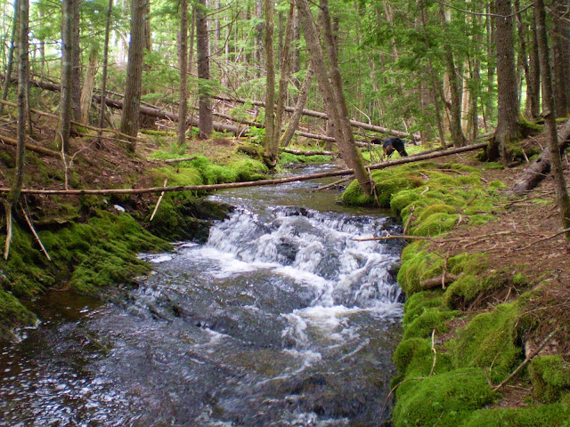
McLOED BROOK FALLS
Gore, Hants County
45N03.803 63W50.654
20T E433535 N4990338
RIVER: McLoeds Brook
CLASS: cascades
SIZE: 4', 4'
RATING: average (**)
TRAIL: none
DISTANCE: 500m
HIKING TIME: 45 minutes
CONDITIONS: moderate
GEOCACHE: none
NS Atlas Page: 48/X3
NS topo map: 011E04 (Kennetcook)
DRIVING DIRECTIONS: from windsor, take Exit5 from HWY101, eastbound towards Brooklyn on HWY14. Drive 8.6 km to this small village and turn left at the war memorial in the middle of the road onto HWY14/215. At the intersection on top of the hill, 750m along, continue straight on HWY215 for 1km the n turn right onto HWY236 and drive 19.8km. Turn right onto HWY202 and drive 9.7km then turn left onto Tom Barron Road. Drive approximately 600m and park off the side of the road.
TRAIL DESCRIPTION: bushwhack down to the brook, and hike upstream. The fringe along the brook is fairly clear of deadfall and covered in a thick carpet of moss which makes the hike somewhat easier.
Two small cascades, each of about 4 feet in height, these are not the most spectacular falls in Nova Scotia but the sheer beauty of the moss draped woods surrounding this location, and the peaceful moss covered outcroppings at the falls are perfect spots to sit and enjoy the babbling brook.


No comments:
Post a Comment