WEIR BROOK FALLS
Newport Corner, Hants County
N 44° 57.660 W 063° 58.456
20T E 423161 N 4979080
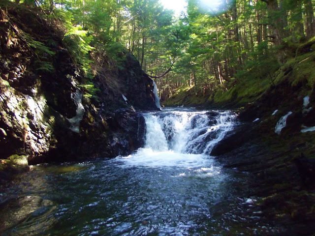
(Upper Weir Brook Falls)
RIVER: Weir Brook
CLASS: multiple
SIZE: 25',20'
RATING: excellent (***)
TRAIL: none
DISTANCE: 500m
HIKING TIME: 1.5 hours
CONDITIONS: upstream, some moderate climbing
Geocache: none
NS Atlas Page: 58/V1
NS topo map: 11D13 (Mount Uniacke)
(Lower Weir Brook Falls)
DIRECTIONS: from Windsor, downtown, take HWY101 , south, 10.5km to exit 4. Exit east onto HWY1 Continue along this road approximately 1 .5km, to an unsigned road on your right just before a big left-hand turn. (WPT: 44 N 57.750 063 W 58.931)Follow this road to a small pull off just beyond the quarry.
Trail Description: walk along the tree line next to a large field, heading down a well-used trail to the main falls. A rope is in place to help you descend into the deep canyon next to the lower main falls. You will need to cross the stream and climb up the steep trail next to the small cave, turning left at the top and descending again to the base of the upper falls.
The main falls site at Weir Brook shows the remains of human interaction, with a concrete wall and iron spillway helping to form the large pool underneath the lower falls. This is a popular swimming hole in the summer, with outdoor enthusiasts jumping off the top of the falls into the pool below. Even in mid-August,
the pool here remains ice cold.
The upper falls are only 30m upstream and can be seen from the lower falls site, another 20' steep cascade into a pool below that runs out along a fast moving cataract to the lower falls. These falls retain the wild aura of the site, hemmed in by rock cliffs on either side of you.
photo by Tammy Elliot (2014)
Downstream from the main falls are two smaller falls that are easily reachable if you dont mind getting your feet wet a few times crossing back and forth over the stream. The first set of these is approximately 75m downstream, another 100m takes you to a second set that tumbles into another nice pool.


No comments:
Post a Comment