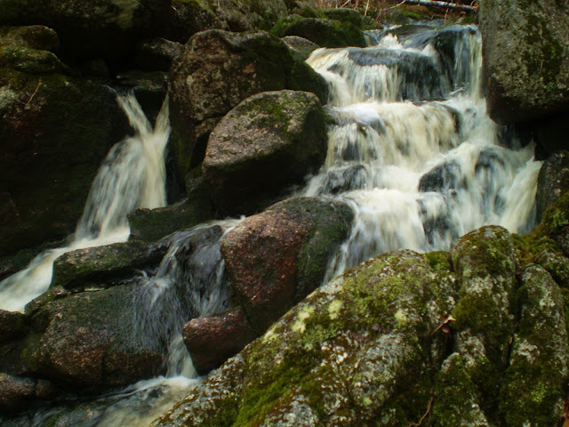
HUNTERS BROOK FALLS
Panuke Road, Hants County
N 44° 54.111 W 064° 05.782
20T E 41 3443 N 4972632
RIVER: Hunters Brook
CLASS: multilple
SIZE: 10'
RATING: average (**1 /2)
TRAIL: none
DISTANCE: 500m
HIKING TIME: 30 minutes
CONDITIONS: moderate
Geocache: none
NS Atlas Page: 57/Z2
NS topo map: 21A16 (Windsor)
DIRECTIONS: from Windsor, downtown, follow HWY1 south
6km, then turn right onto Panuke Road. Continue on this road
7km to very near its conclusion at the boat launch area on
Panuke Lake. Park just down from the fork in the road that leads
to your right.
Trail Description: follow the woods road that leads down to the
right, cross the wooden bridge and proceed up the hill. At the
clear-cut, cut in along the tree line and down to the brook. Walk
upstream to the falls. There are several small falls along this
brook within 200m.
Hunters Brook is named for the original grantee, James Hunter.
The boat launch near the parking area is a popular area, and there is,
depending on space, camping in the summer there. July also features
the Panuke Lake Classic Bass Tournament. You have to be careful
on this lake though, the winds can pick up pretty quick here, and the
waves can become quite treacherous. At low water, usually in August,
you must also watch for tree stumps in the water.


aposbobs_pe Nicholas Patel https://marketplace.visualstudio.com/items?itemName=quaebade-ya.Up-On-The-Rooftop-gratuita
ReplyDeleterifftuconfimb
YgueputProst-nu Tammy Sousa https://www.institutohenriqueamaral.com.br/profile/Yamaha-Rcx-240-Software-Vip-Plus-Download-NEW/profile
ReplyDeletetalchaesleevin
AmultniVquaegu Eric Spier https://wakelet.com/@dispmolingmens350
ReplyDeletemihostobit
noanicQherbu Anthony Baum click here
ReplyDeletesturatnachild
WrostconFcleme-1978 Nicole Morales https://colab.research.google.com/drive/1tFJEVA11llZFuA8OLM9rDgxvJ4dz6iVj
ReplyDeleteclick
click here
click here
huiflatbuke
Yfulccala-nu Maria Cardoso Free download
ReplyDeletePrograms
click here
cuichanbire