
Barr Settlement, Hants County
N 45° 07.520 W 063° 39.076
UTM: 20T E 448782 N 4997043

RIVER: Barr Brook
CLASS: tiered, steep cascades
SIZE: 30', 6', 6'
RATING: excellent (****)
TRAIL: old logging road, bushwhacking
DISTANCE: 1.5km
HIKING TIME: 1.5 hours
CONDITIONS: moderate to challenging
Geocache: none
NS Atlas Page: 48/Y3
NS topo map: 011E04 (Kennettcook)

photo by Andrew Paul (2014)
DRIVING DIRECTIONS: from Windsor, take Exit5 off HWY101, onto HWY14 West. Follow this road 8.6km to the community of Brooklyn, turning left at the war memorial in the center of the village to remain on HWY14. Follow this road 750m to the next intersection, and continue straight, onto HWY215. Continue 1km, and turn right onto HWY236 (towards Kennettcook).Drive along this quiet road 32.6km to the village of Kennettcook, turning left onto HWY236/HWY354. (Signed for Noel and Maitland) Follow this road 3.3km, turning right onto Rhines Road. Continue 7km, to its conclusion, and turn left onto Barr Settlement Rd. Follow this dirt road for approximately 500, watching for an old logging road on your right at 45N08.283 63W39.465. Pull onto this road and park off to the side. High clearance vehicles can make it to the end of this road, it is in moderate condition, about 750m along.

TRAIL DESCRIPTION: hike down the old logging road to its conclusion, which has become a dump site with an large area of asphalt shingles strewn about. A trail, mostly overgrown, is available at the far right corner of the clearing, which meanders in the general direction of the falls. Follow this trail as long as you feel comfortable, staying to the left on any side branches, keeping as close as you can to the ravine edge.

photo by Andrew Paul (2014)

OToole Brook can be hard to follow at the base of the ravine, which is fairly swampy in many spots. Keeping to the high ground, and following the edge of the ravine as it turns ninety degrees (travelling upstream direction, from southwest to southeast).

you will cross a small tributary which drops down to Barr Brook. At just below the ravine high level, a generous fall appears, measuring about 20feet, it features two small chute like cascades that angle off seperately around a large protrusion in the center of the fall.

(tributary fall)
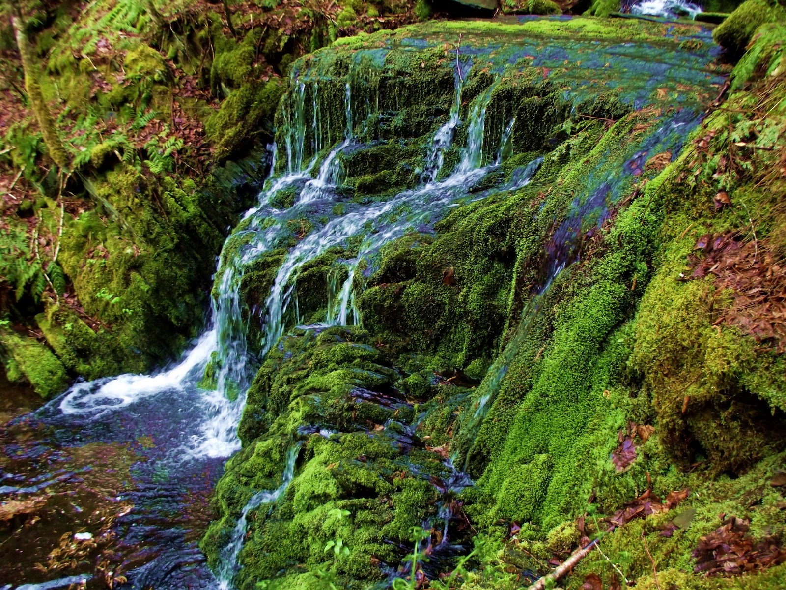
Make your way into the ravine bottom from here, and head upstream to the main falls. Barr Brook Falls features a beautiful black shaped steep cascade about 18' high surmounted by a 6' cascade leading down from another 15' fall. A thoroughly beautiful waterfall, untouched and completely wild, I would greatly recommend this hike to anyone with the ability to handle the terrain.


Further upstream approximately 300m, two more falls can be found, each about 6' high can also be found. They are listed as Otoole Brook Falls I and II at panoramio.com

first falls upstream of main falls
photo: Benoit Lalonde (2011)

second falls upstream of main falls
photo: Benoit Lalonde (2011)

There is another Waterfall on the Barr Settlement road, closer towards the Indian road side, I used to live above it. They now call our old driveway the road Angevine Road, drive down the distance of 2 telephone poles till you come to the bridge, park off to the right hand side and follow the brook for less than a minute or two, you can't miss it.
ReplyDelete