
Hatchet Lake, Halifax County
N 44° 34.750 W 063° 43.762
UTM: 20T E 442095 N 4936462

RIVER: Prospect RIver
CLASS: cascade
SIZE: 12ft
RATING: average (***1/2)
TRAIL: woods trails (mountain bike trails)
DISTANCE: 1km
HIKING TIME: 45minutes
PARKING: 44N43.132 63W44.083CONDITIONS: moderate
Geocache: GCKK7X
NS Atlas Page: 67/X4
NS topo map: 011D12 (Halifax)

DRIVING DIRECTIONS: from HALIFAX, at the Armdale Rotary, head west on HWY3 (St. Margarets Bay Rd) for 3.6km and then turn left onto HWY333 (Prospect Rd). Follow this road for 10.2km and then turn right onto McDonalds Lake Rd. Follow this residential street for 700m to its conclusion at a small cul-de-sac and park.

TRAIL DESCRIPTION: follow the hiking trails that begin on the right hand side of the power pole (not the driveway on the left hand side). Id suggest having one's GPS receiver on hand for this one as there are many many cross trails in the area. Make a beeline towards the shores of Nichols Lake and follow the shoreline trail, somewhat overgrown, to the brook that empties into the lake, or alternately, follow a higher ground (but less picturesque) trail to the brook and hike downstream. The falls are nearer to the outlet into the lake.
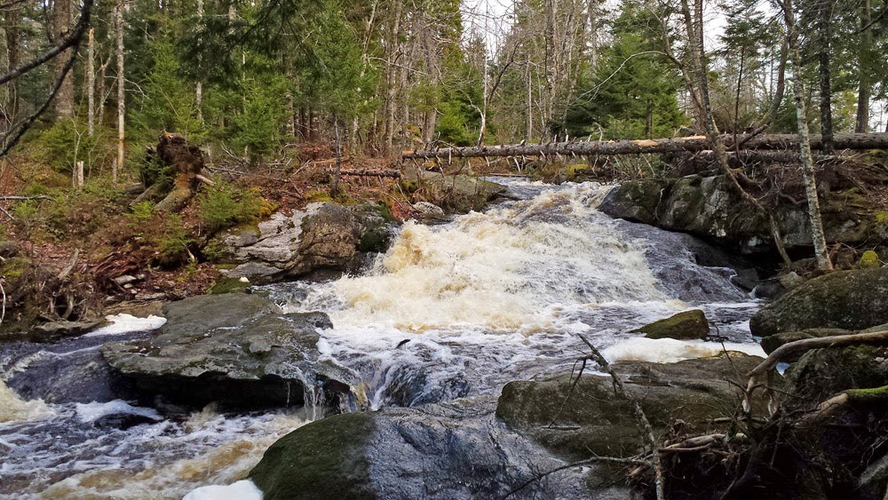
photo by Scott Baltjeo (2014)

(sunrise, and fog, on Nichols Lake)

No comments:
Post a Comment