
Newport Corner, Hants County
44N57.013 63W58.194
20T E0423491 N4977877

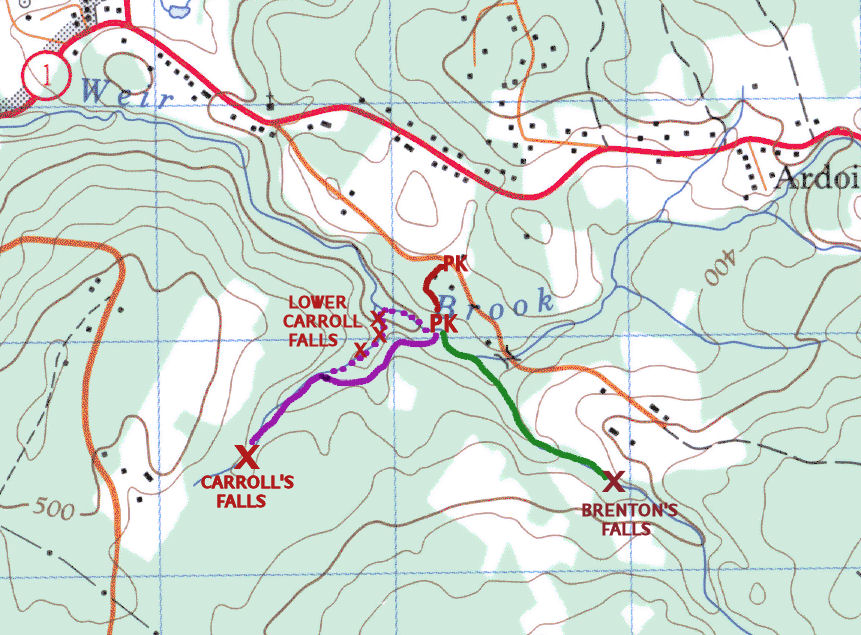
RIVER: tributary of Weir Brook
CLASS: steep cascade
SIZE: 30'
RATING: excellent (***)
TRAIL: bushwhacking
DISTANCE: 1.5km
HIKING TIME: 1 hour
CONDITIONS: moderate
Geocache: none
NS Atlas Page: 58/V1
NS topo map: 11D13 (Mount Uniacke)
Driving Directions: take Exit4 from HWY101, east onto HWY1. Travel 4.3km and turn right onto Collier Road. Follow this road about 1km, watching for a woods road on your left. If you have a high clearance vehicle, you can take this road down the hill to a nice parking area near the brook (at 44 N 57.240 63 W 57.684); otherwise pull in here and park off to the side.
Trail Description: from the upper parking area, walk down the hill along the road, about 350m, to Weir Brook below. Cross the brook where you can see the road continue along the other side, continue along the road another 400m, up the hill and along the ravine edge. When you come to the bridge over the tributary stream, turn upstream. Hike up alongside the stream 500m to the falls.

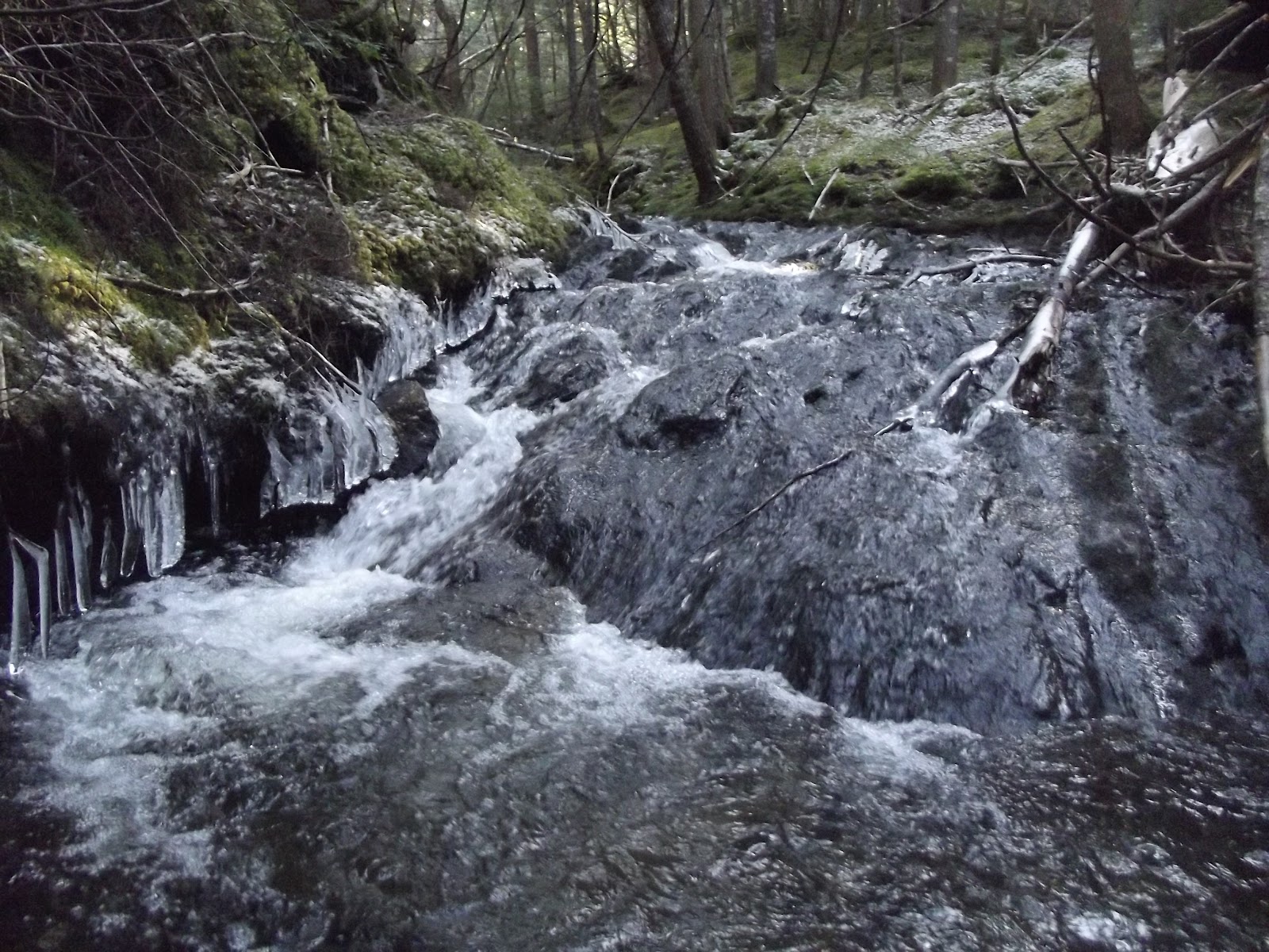
On the land of the original grantee, Thomas Carroll, these falls drop down a twenty foot steep cascade, take a 90 degree turn and fall down another 10' cascade. Climbing the left side of the falls is the easiest ascent to the top.

On your return trip, when you reach the bridge, continue downstream instead of hiking back up over the hill. There are three beautiful cascades in this rocky canyon, including a nice slide fall. They are marked on the map as Lower Carroll Falls.


No comments:
Post a Comment