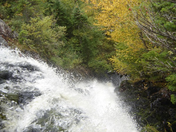
Margaree Valley, Inverness County
46N23.036 60W53.427
20T E662212 N5138868
photo Benoit Lalonde
RIVER: Martha Brook
CLASS: plunge
SIZE: 80'
RATING: excellent (****)
TRAIL: bushwhacking
DISTANCE: 350m
HIKING TIME: 1 hour
CONDITIONS: VERY difficult
GEOCACHE: GC148BX
NS Atlas Page: 9/W3
NS topo map: 011K07 (St. Anns Harbour)
photo Robert Pierrynowski
DRIVING DIRECTIONS: from Baddeck, head SW along the Trans Canada Highway (HWY105) about 9km and turn right onto HWY19 (the Cabot Trail). Drive 31.8km to North East Margaree and turn right onto East Big Intervale Road. Drive north along this road 4.2km and turn left onto Fielding Road at the village of Margaree Valley. Follow this road 8.8km and turn left onto Caribou Road. Turn left again about 300m along, and continue down this road approximately 500m, parking anywhere on the side of the road.
photo Geoscotians
TRAIL DESCRIPTION: bushwhack down to the brook below the falls and hike upstream to the falls. Easier said than done, though. The descent into the ravine here is very steep, at times approaching 75-80 degrees, so extreme caution will be necessary, and one should NEVER attempt these falls on yuir own. The slope is covered in beech and maple trees and a deep carpet of moss which covers the large boulders and can disguise holes in which ankles can be caught into very easily.
photo Geoscotians
Stunning, and quite unforgettable, you will remember these falls both for the sheer size of the plunge, but also for the treacherous descent (and eventual ascent) to the base of the falls. Coming at these falls from above the plunge is possible but dangerous. If you have rope, bring it, use it.
looking over the precipice
photo Robert Pierrynowski


Did you mean turn left onto Fielding road?
ReplyDeleteGreat post thanks.
ReplyDelete